interpretive
TRAILS
interpretation trails...
a familiar product open
to be reimagined for visitors
to explore in a
mobile-optimised world
reimagining interpretive trails
Traditionally interpretive trails have been thought of as controlled spaces with defined entry and exit points wherein prescribed narratives are delivered along the course of the trail.
Today we have the chance to better understand and to reimagine the potential of interpretive trails as we enter the second decade of the mobile revolution.
Rather than visualising interpretive trails as a prescribed pathway, we can now imagine them as presenting visitors with a matrix of opportunities with multiple points of connection and layers of meaning.
Just as people now expect to be able to customise their information flows and experiences to meet their own needs and interests, so also can interpretive trails look to adapt and flourish in these new operating environments.
A crucial opportunity for the future development of interpretive trails lies in recognising that they are not defined by the delivery of a single experience set in the way that a bike trail, a walking trail, a horse trail or an audio trail is.
Interpretive trails can present a matrix of opportunities and engagement points such as can equally connect with the entire spectrum of a locality's user groups.
In this they can envelop a precinct so as to invite all the users equally (irrespective of their native language or choice of experience) to appreciate the heritage values of the place they are exploring.
It is this inclusive quality that gives the interpretive trail product such an open ended matrix of possibilities to explore in a post 2020 operating environment.
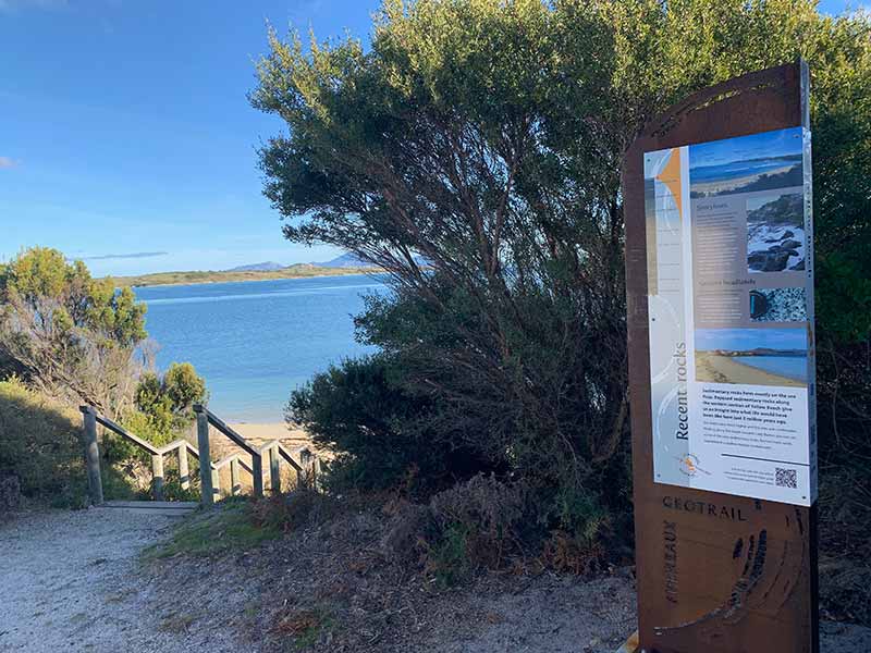
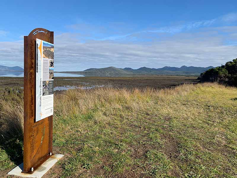
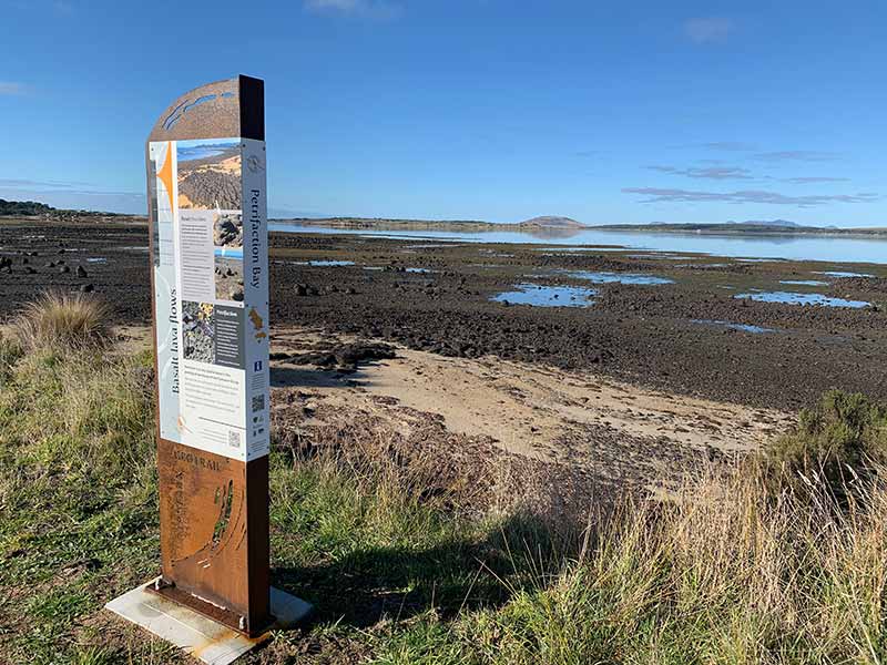
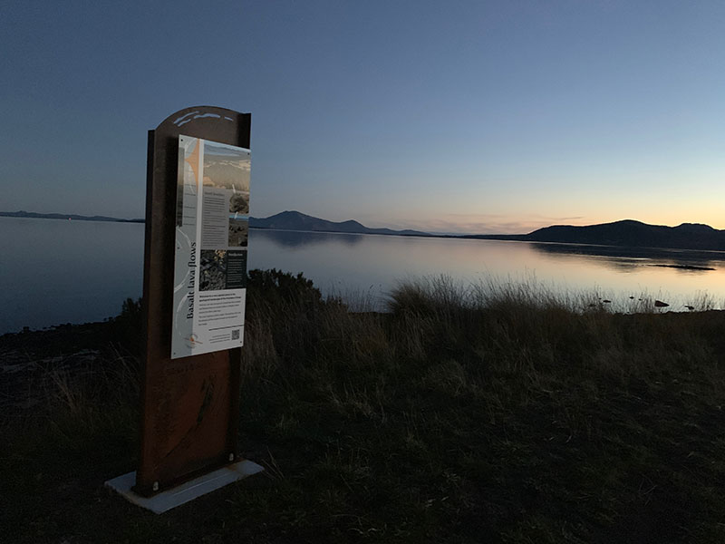
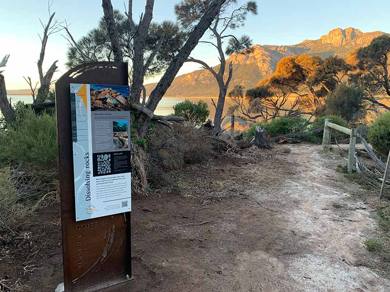
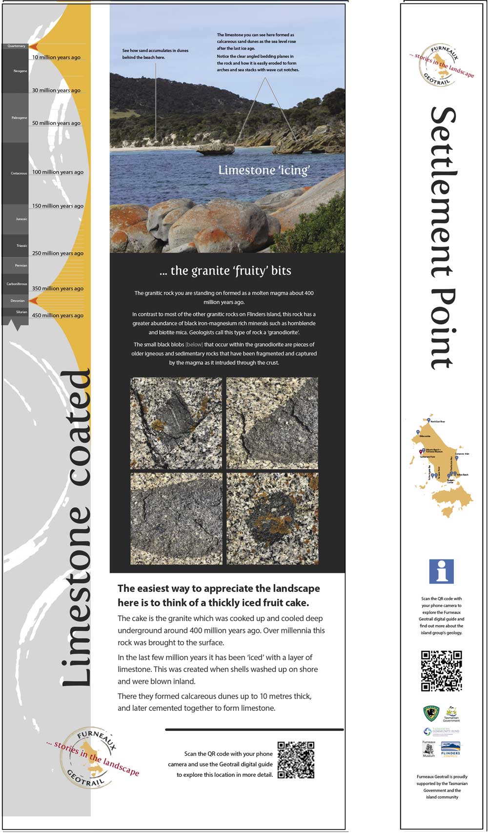
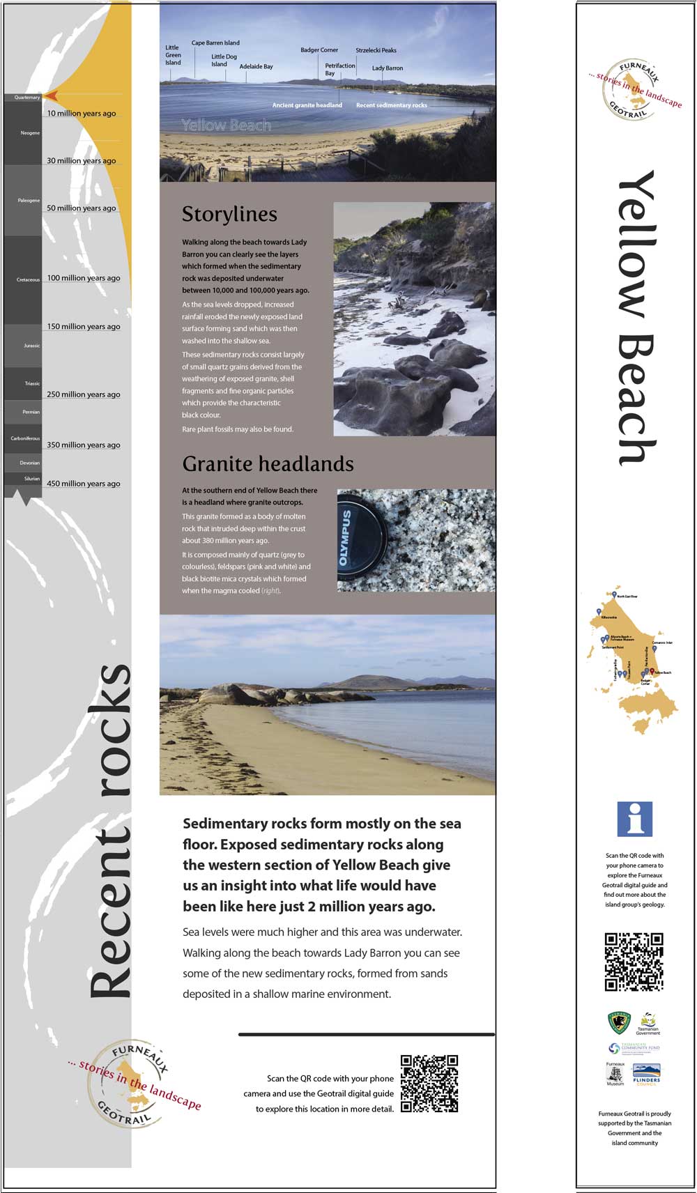
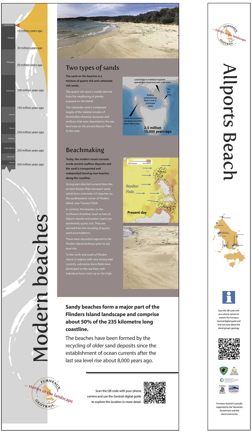
Geotrails provide an interesting model against which to examine the development of interpretive trails. By their very title, they embody the way in which "trail" is elevated to the status of being the brand proposition defining the experience on offer.
Geology is by its very nature a supporting medium - a foundation upon which other narratives stand. Elevating this to centre stage as the essential brand proposition of the interpretive trail requires carefully planned and fully integrated product delivery across a wide array of visitor experience sets.
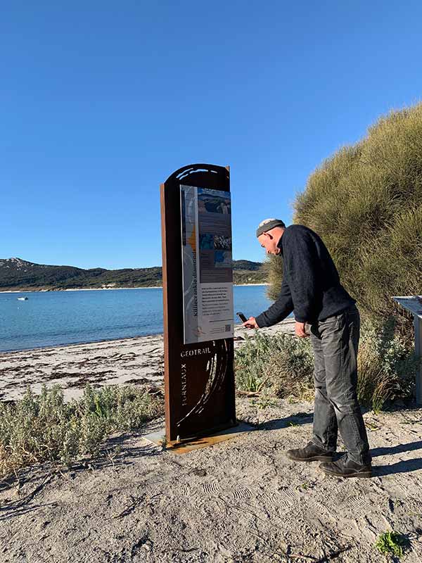
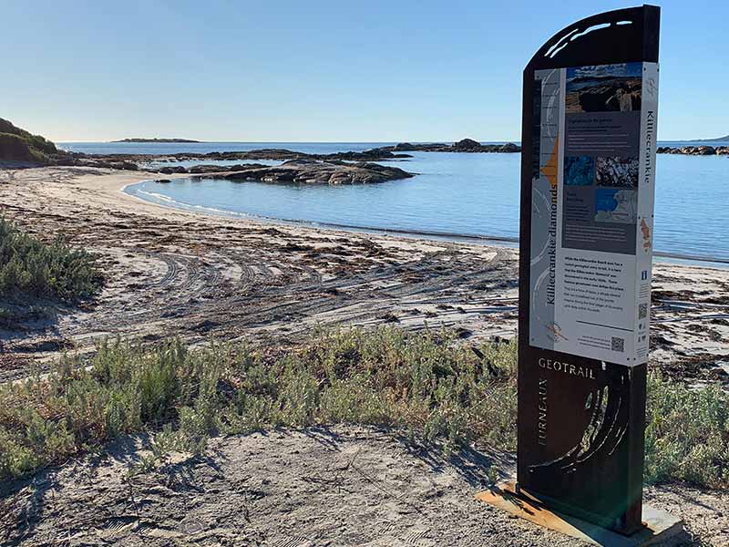
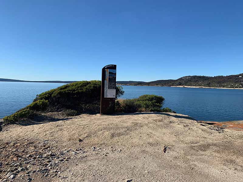
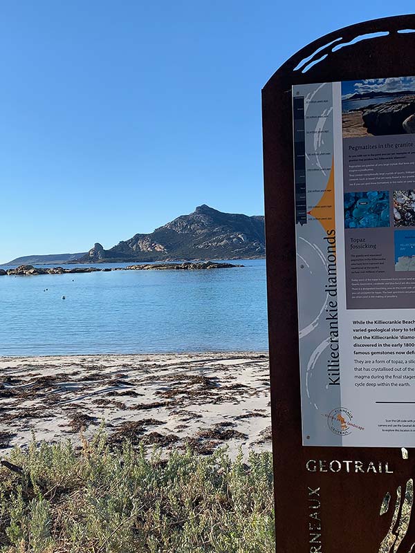
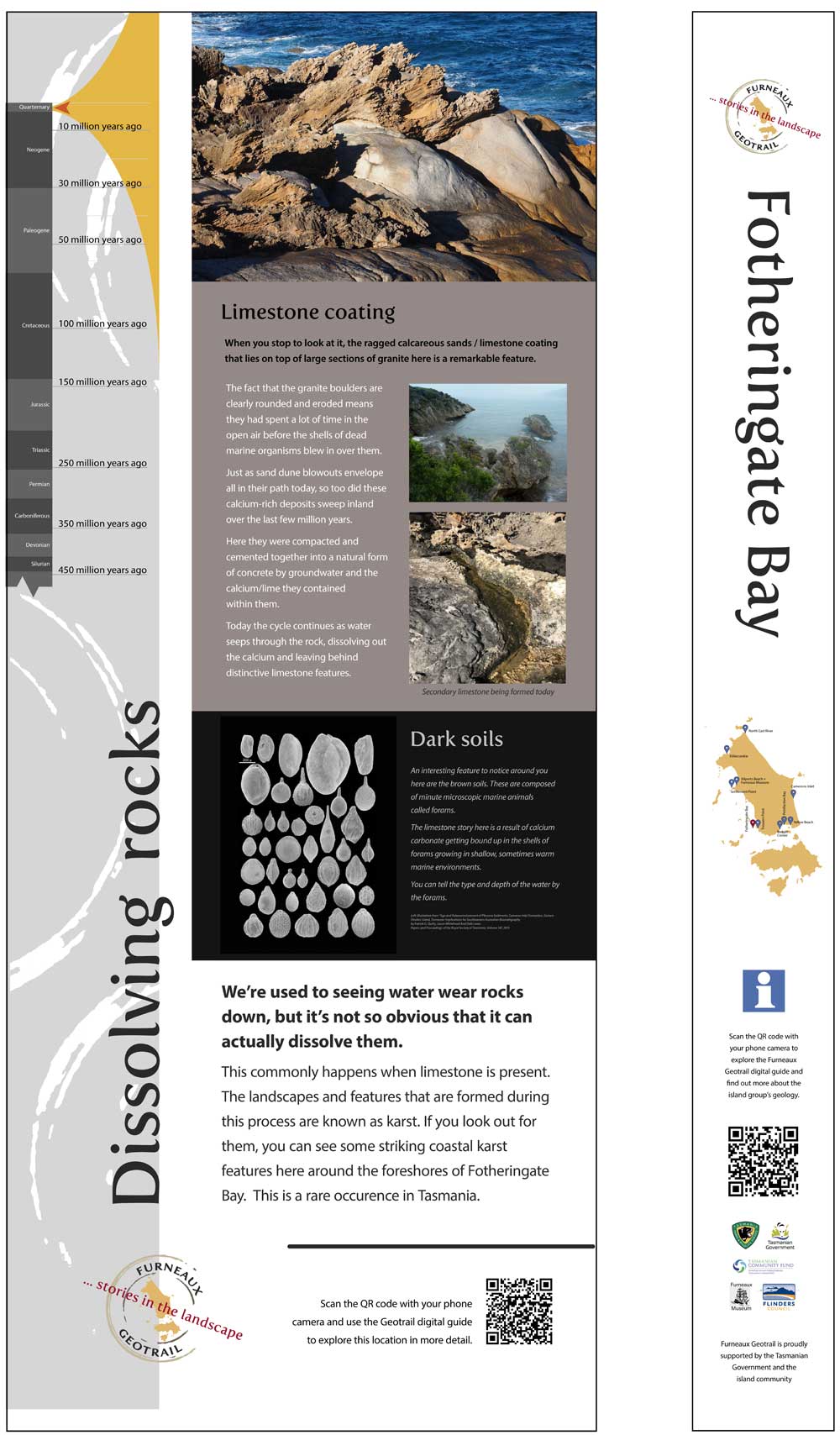
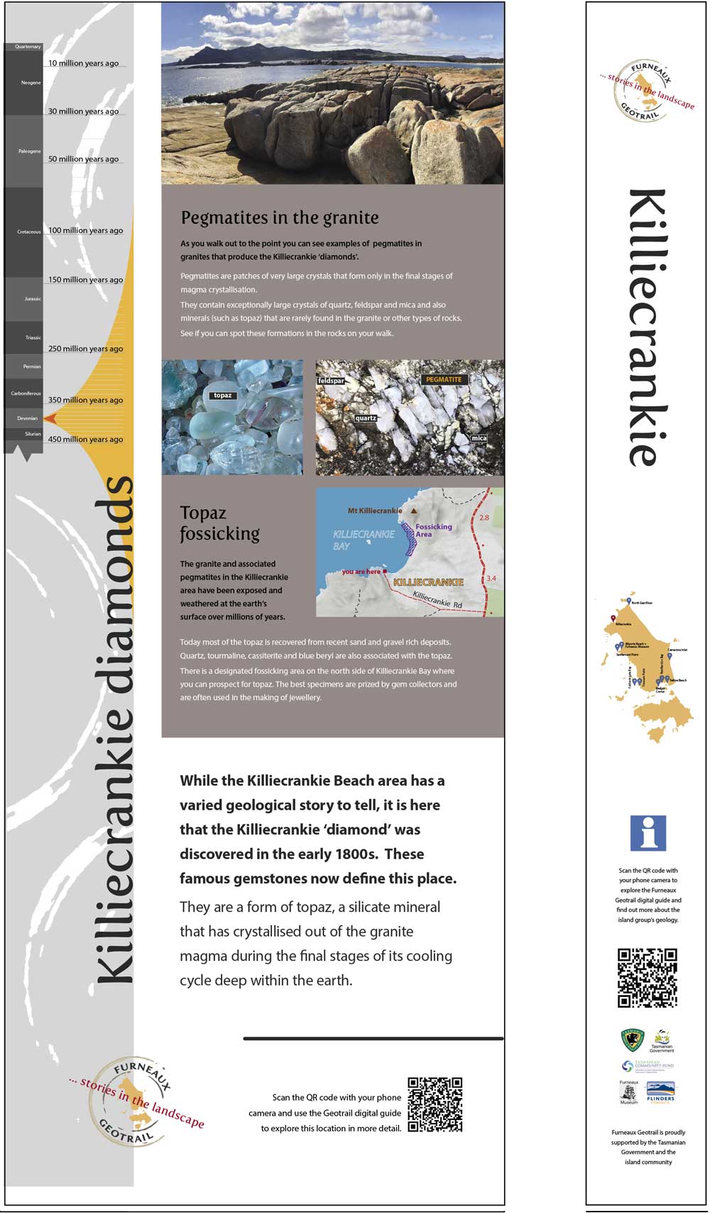
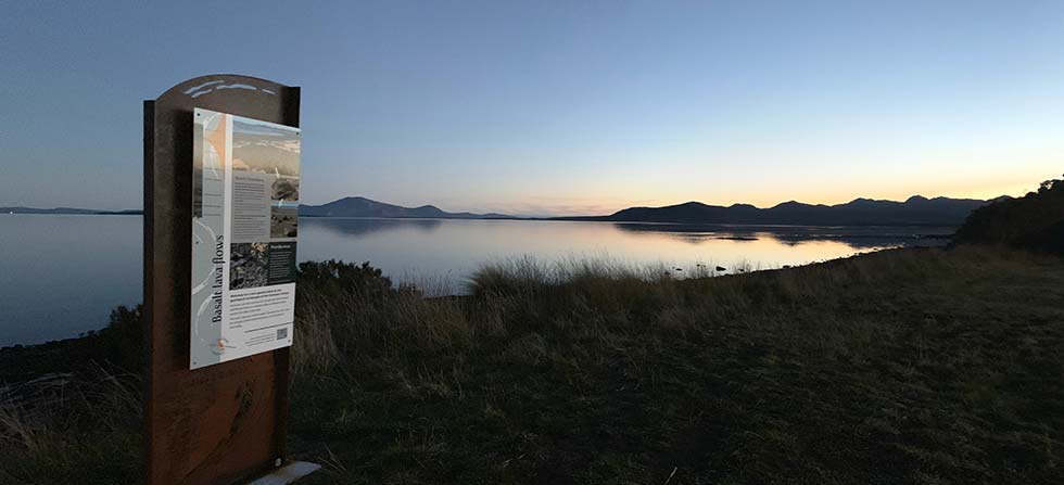
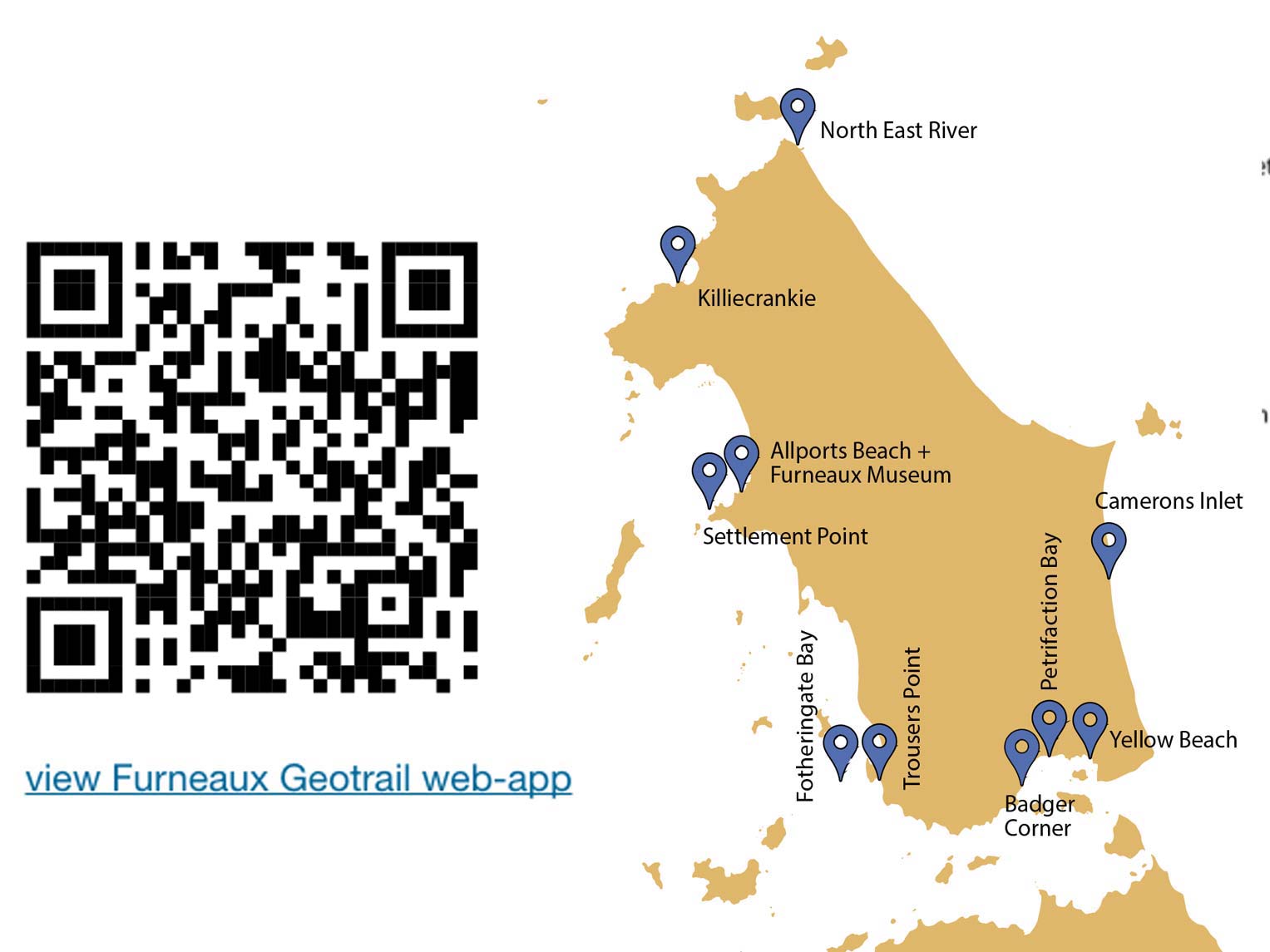
This is an approach currently being explored in the roll out of the Furneaux Geotrail in Bass Strait. (N.B. Stage 1 works are in place and the roll out of future Stage 2 and 3 project components is ongoing.)
The essential asset underpinning the the Furneaux Geotrail is an outstanding geological story to tell. This then needed to be assessed against the array of the existing publicly accessible locations that people could visit so as to piece together for themselves an appreciation of the stories written in the landscape.
The crucial feature here lay in recognising that the new product's chances of success are increased if it coincides with and complements existing visitor flow patterns. Creating genuinely new visitor flows to places previously little known or thought of lies outside the realistic ambitions of most projects.
The additional advantage of aligning the new product alongside familiar visitor pathways is that it provides multiple entry points for casual engagement with the product. While some visitors may indeed take up the brand offer to follow the trail proposition from one venue to another around the island, others may simply find in it a familiar presence that embellishes their other activities.
This approach accords with the notion of providing multiple points of access to the trail experience. Not only can people access it from a variety of geographic points of entry, but similarly the variety of interpretive media on offer also provides multiple points of access for the visitor.
A feature of the Geotrail interpretive trail approach is the way in which it adopts a branded headline proposition in order to link together a network of otherwise disparate locations. As people travel around a broader locale, the interpretive trail stands as a means of connecting together and understanding otherwise disjunct experiences.
Alongside this model, there also exists a more common approach whereby a discrete, relatively contained track section is supported by a consistent interpretive narrative that unfolds as visitors move along the route.
Here the interpretive trail does not attempt to define or brand the experience on offer, rather it simply exists to help the user attribute positive values and meanings to the heritage setting they are visiting.
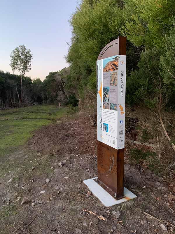
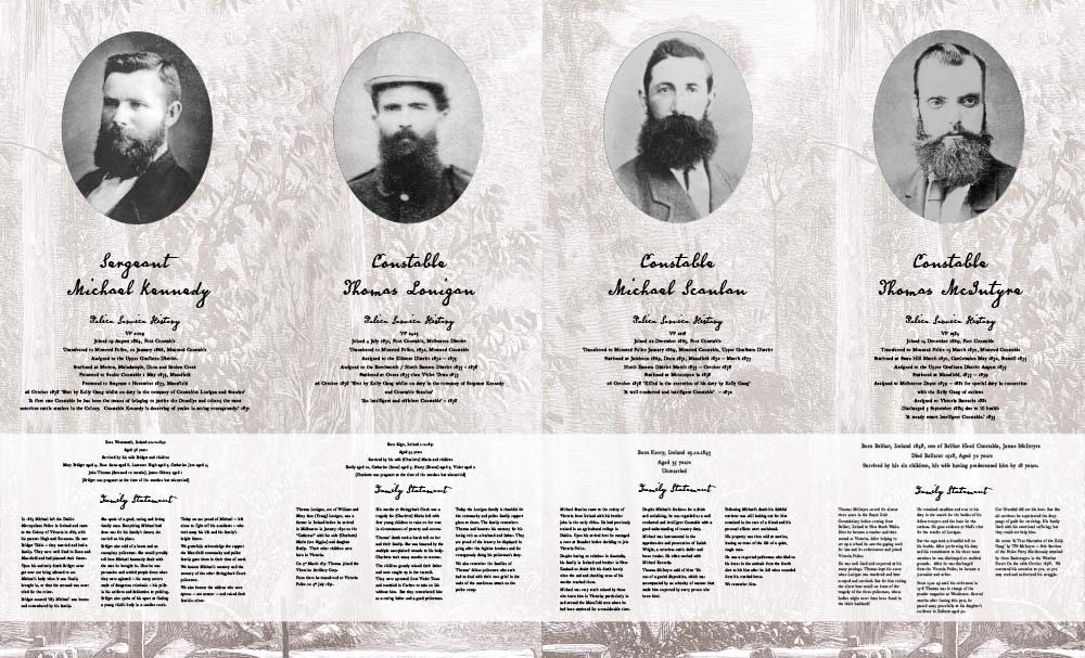
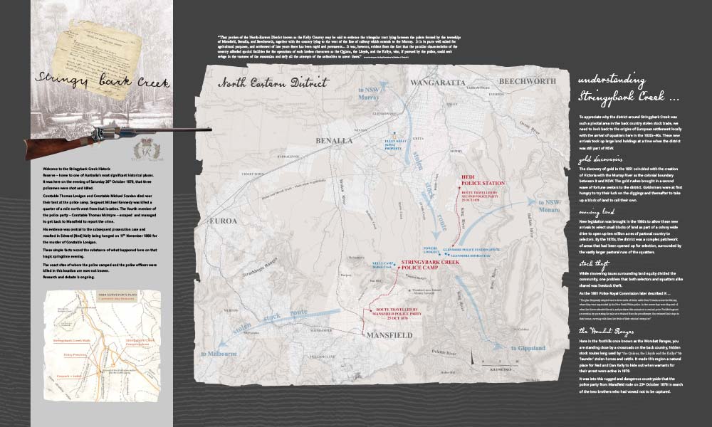
Both the project work at the Three Mile Scrub in Brisbane and also at Stringybark Creek Historic Site near Mansfield in Victoria are excellent examples of this approach in practice.
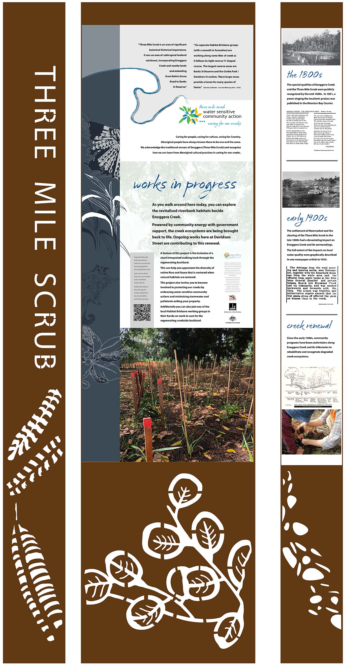
The Three Mile Scrub project is located along a section of Enoggera Creek opposite Davidson Street just north of the Brisbane CBD.
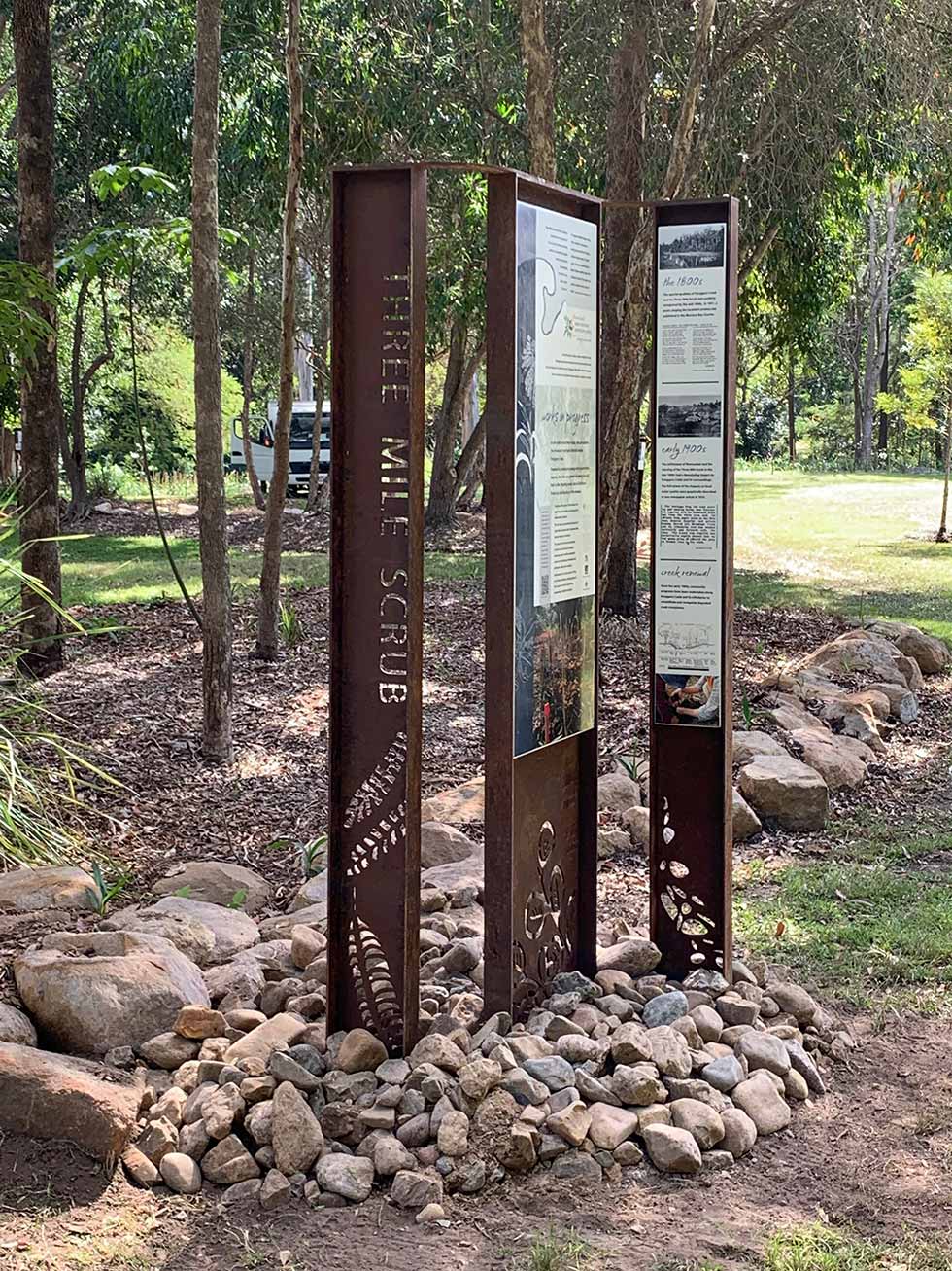
The interpretive works arose as an integral part of a project undertaken by Queensland's Healthy Land and Water agency, not just to regenerate a native section of riverbank, but also most importantly to invite the local community to become custodians and knowledgeholders in relation to this space.
The need to promote Water Sensitive Community Action recognised that the creek was only as healthy as the water flowing into it from surrounding urban catchments. The actions people take in their homes and gardens can make a vital difference in this regard.
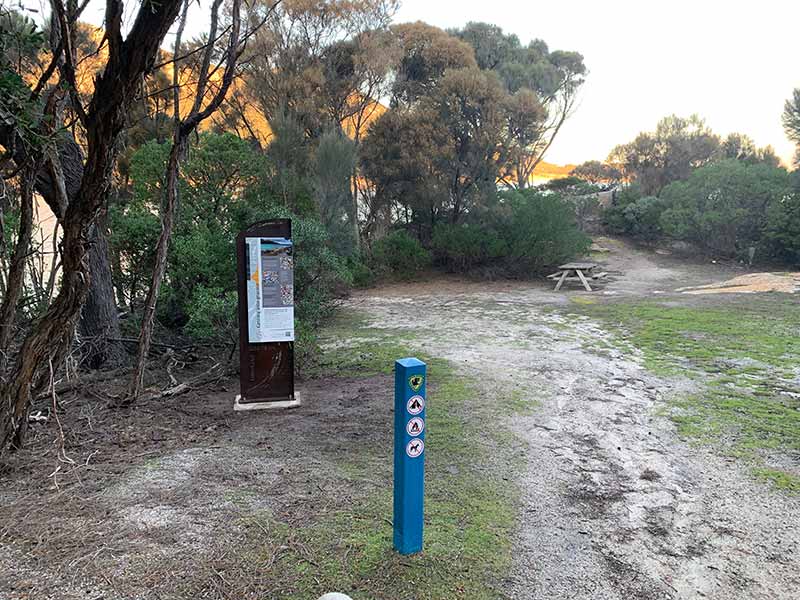
In keeping with the need to reduce the environmental footprint of the interpretive facilities, the signage footprint was kept to a minimum.

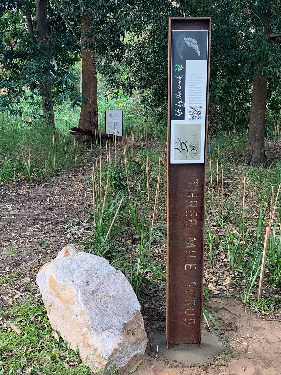
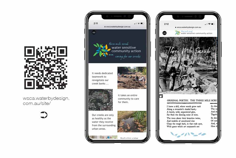
Away from the major entry node, small wayside marker posts invite people to learn more via the supporting web app.
A key feature of this approach includes the close involvement of local school groups who have posted some of their project work on site up on the webapp for everyone to share.
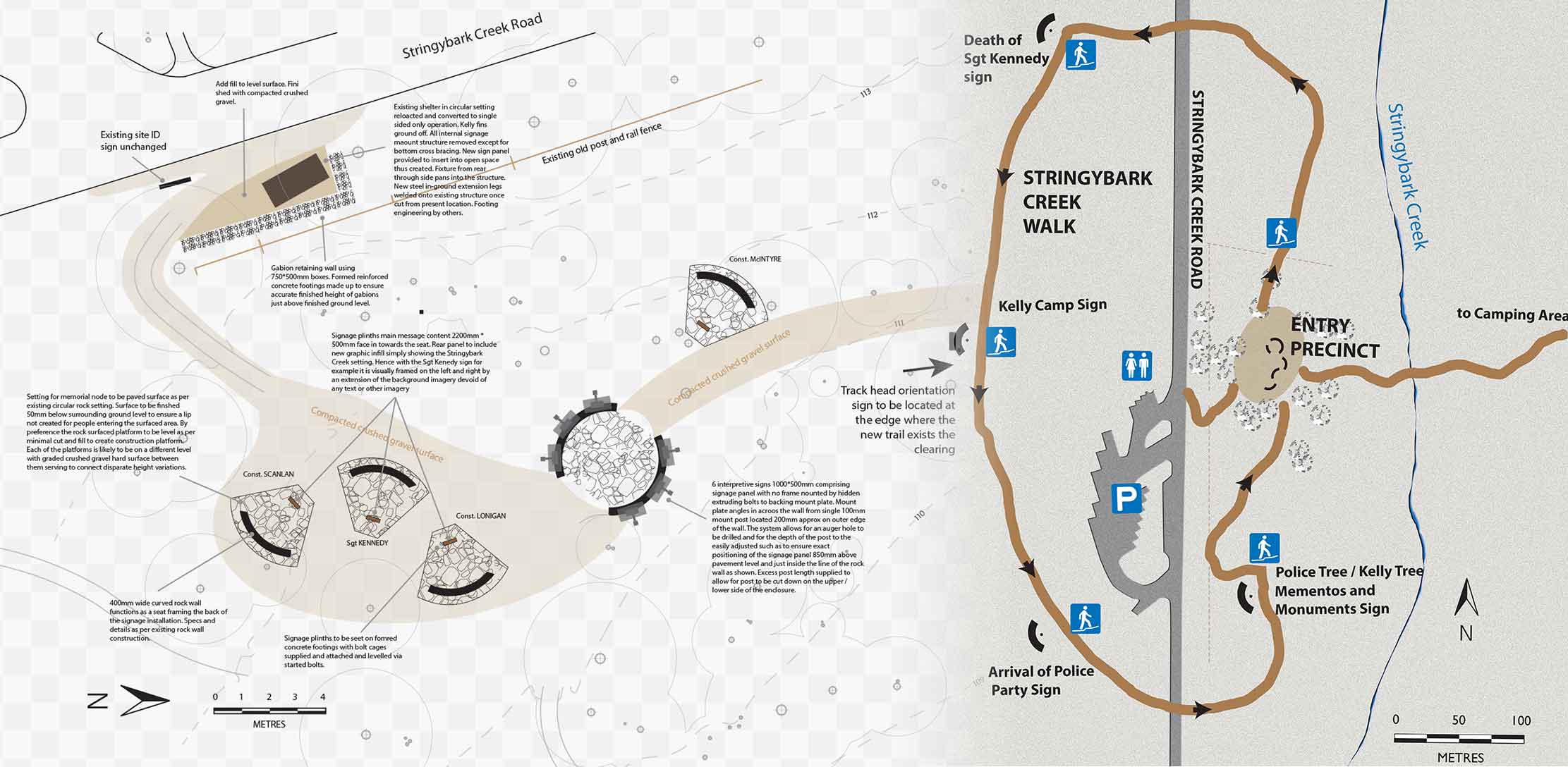
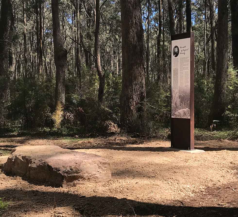
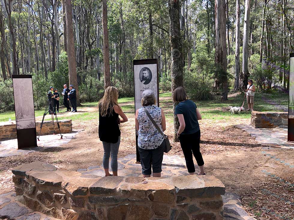
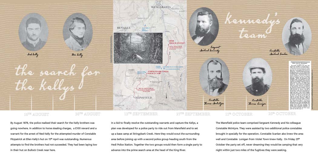
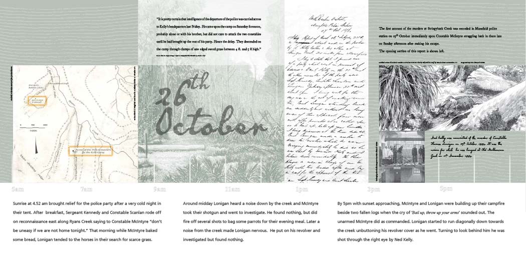
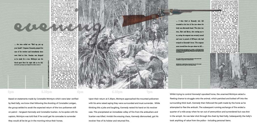
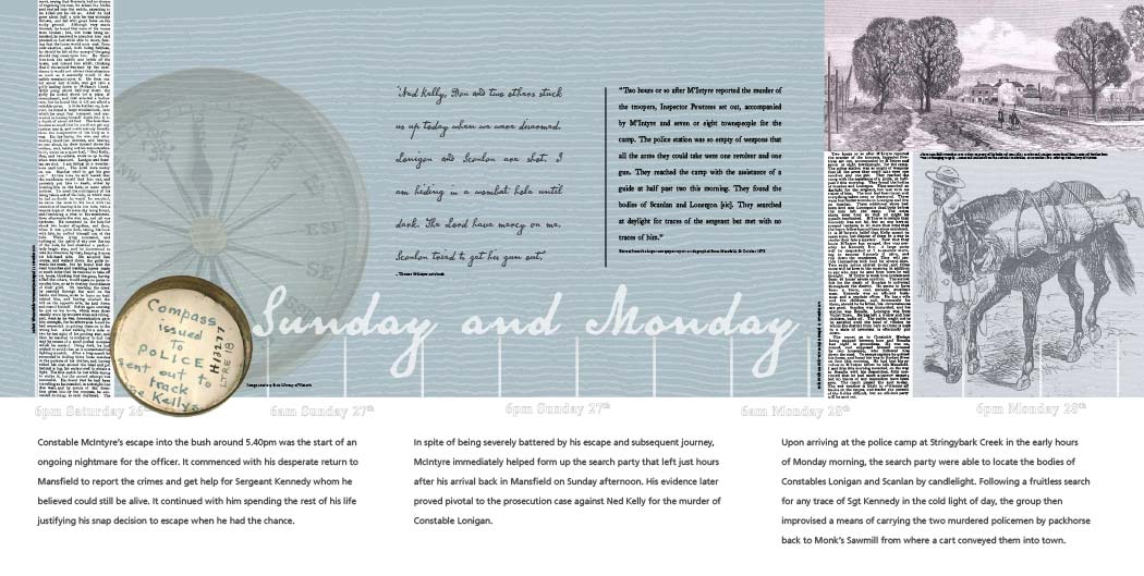
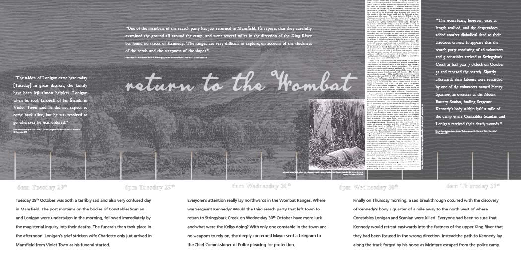
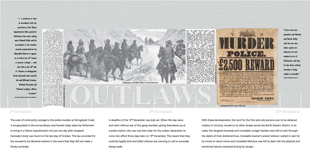
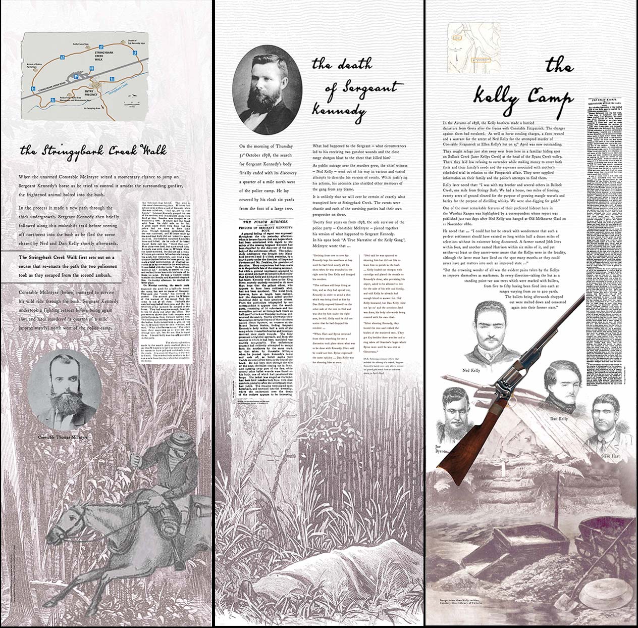
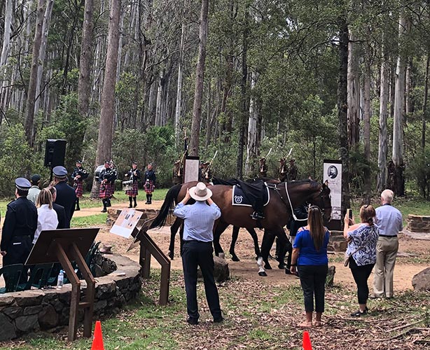
The themed walk around the Stringybark Creek Historic Reserve in Victoria is an interesting example of a moretraditional approach to interpretive trail development. It features some defining characteristics of this conceptual positioning.
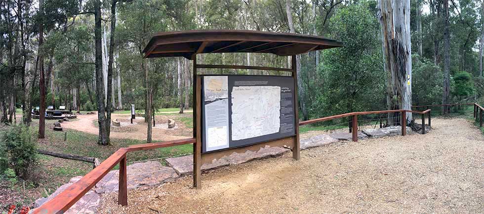
Firstly the walk itself is contained, being a 1.4 km stroll taking around 30 minutes to complete. This provides a "bookended" experience that gives it a stand alone quality separate to the suite of other walk / ride experiences that may be on offer in the locale.
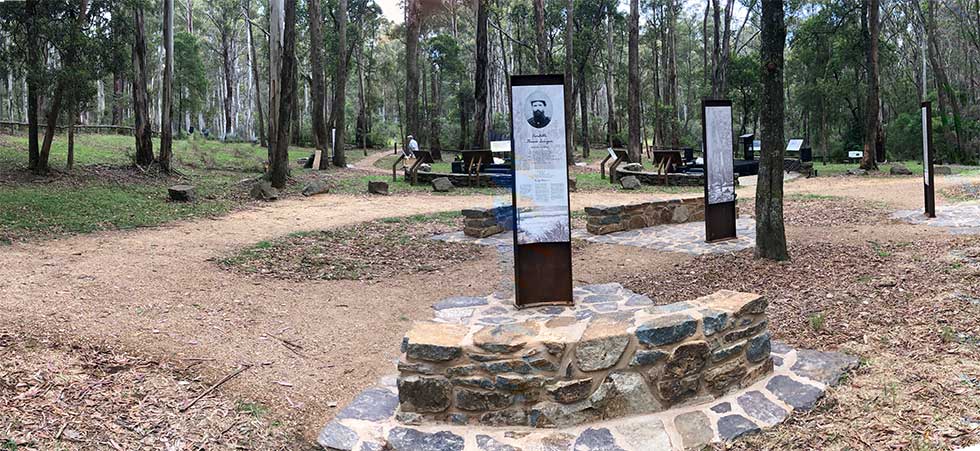
Secondly it recognises that careful landscape interventions are crucial to the successful delivery of the trail experience. Landscaping provides a means of connecting at an emotive and intuitive level with an expereince long before a single word of any sign is encountered.

The precinct speaks to a setting that is valued over and above the ordinary park access track. By including points of repose and inviting the user to step aside from their journey to consider the material on offer it immediately invites an emotional and intuitive response.
This is of particular value to thise who need to "get a feel" for a place before beginning to learn about its particular story narratives.
Landscape trails are defined by their focus on engaging not just with the rational and sensory components of the interpretive experience, but also with the underlying emotive and intuitive elements that can influence the values people ascribe to this encounter.